Professional drone photography and video provide perspectives that traditional ground-based photography simply cannot capture. From showcasing a completed commercial development to producing dynamic footage for a corporate marketing campaign, aerial content can help businesses tell their story in a more compelling way.
We provide professional aerial photography and video designed specifically for commercial marketing, advertising, social media, websites, presentations, and promotional campaigns.
Accurate, detailed information is essential for successful project planning, property management, and construction oversight. Traditional ground-based inspections and documentation can be time-consuming, particularly when working with large properties, complex structures, or difficult-to-access locations.
Professional drone data collection provides a comprehensive aerial perspective, allowing businesses to document sites, evaluate visible conditions, and gather valuable information without relying exclusively on traditional ground-level methods.
At A Tort Aerials, we combine professional imaging expertise with modern drone technology to provide detailed aerial documentation tailored to each project’s requirements.
Whether you’re managing a commercial development, evaluating an industrial property, or tracking an active construction site, our services help you gain a clearer understanding of your project.
Capture detailed aerial photographs of commercial properties, construction sites, industrial facilities, and large land areas.
High-resolution imagery provides a valuable visual record of existing conditions, property features, infrastructure, and ongoing project activity.
Common applications include:
Commercial property documentation
Construction site evaluations
Building and infrastructure inspections
Land development assessments
Property condition monitoring
Project planning and reporting

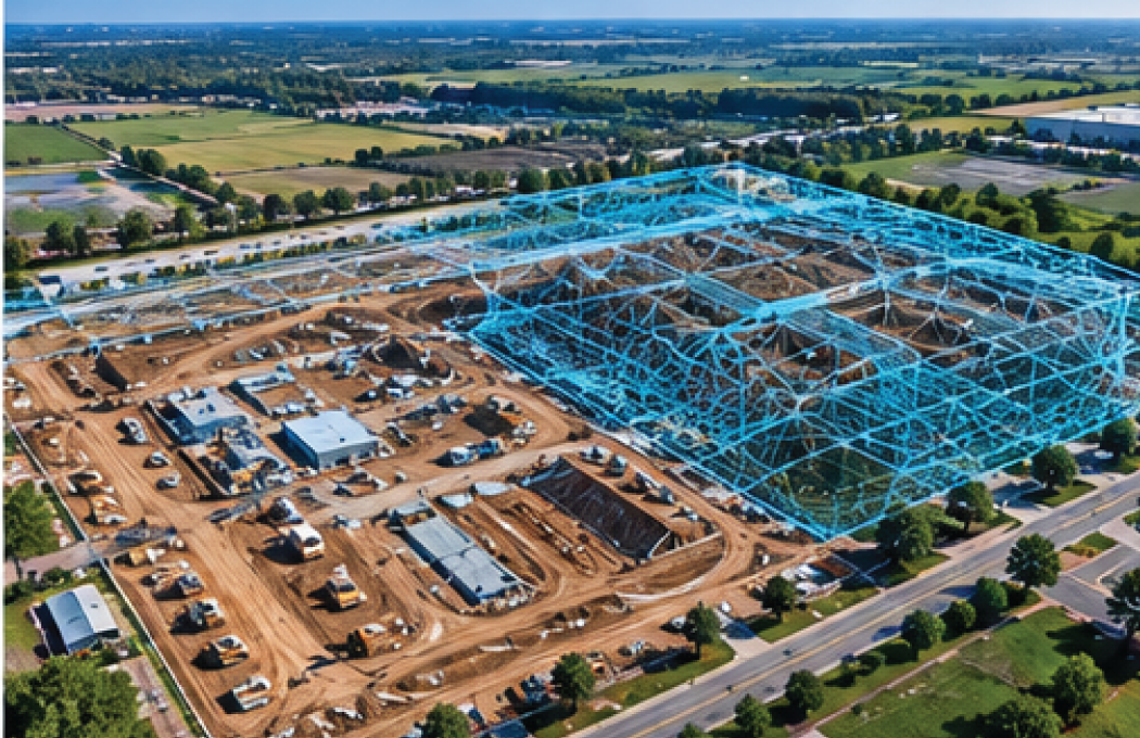
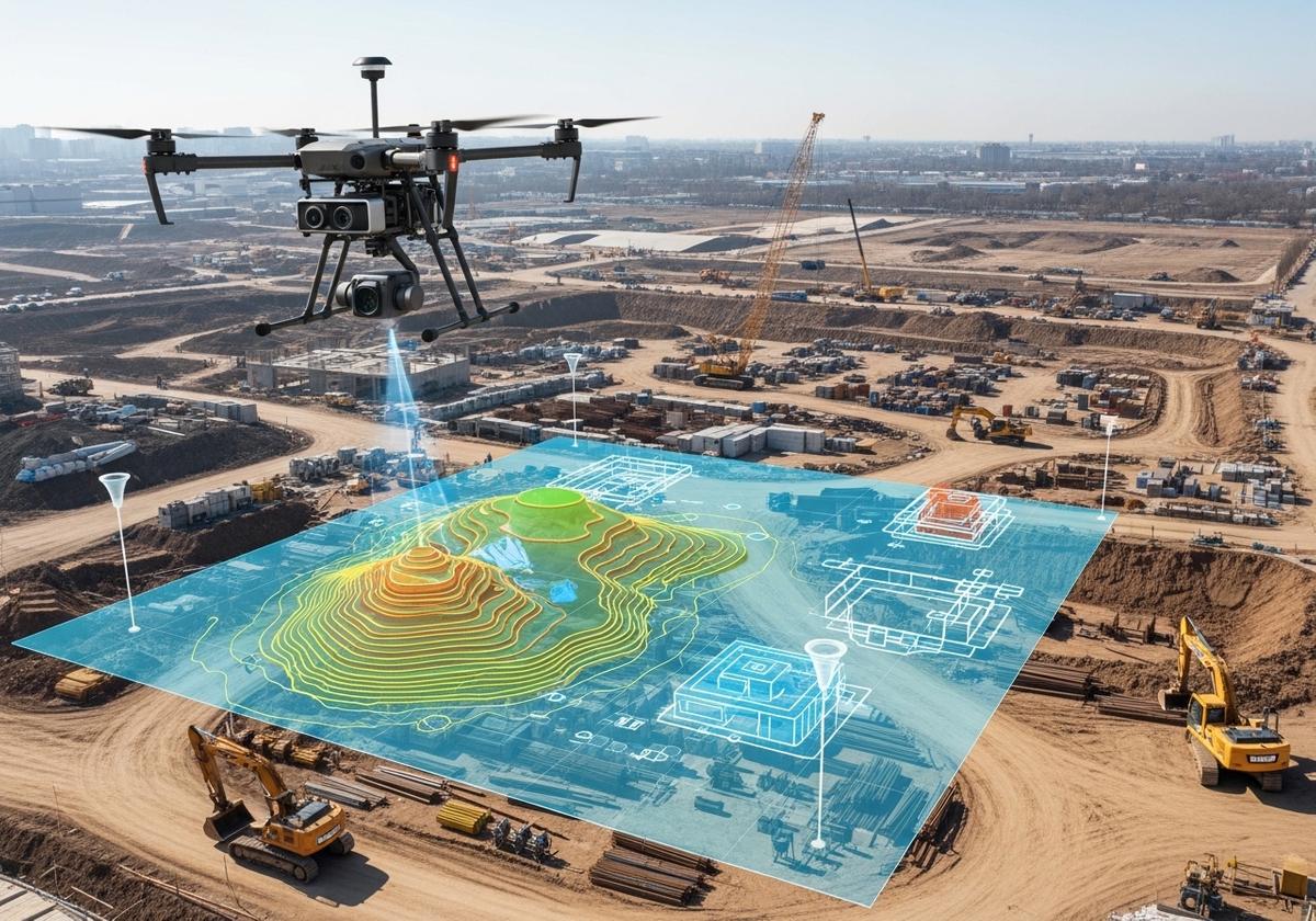
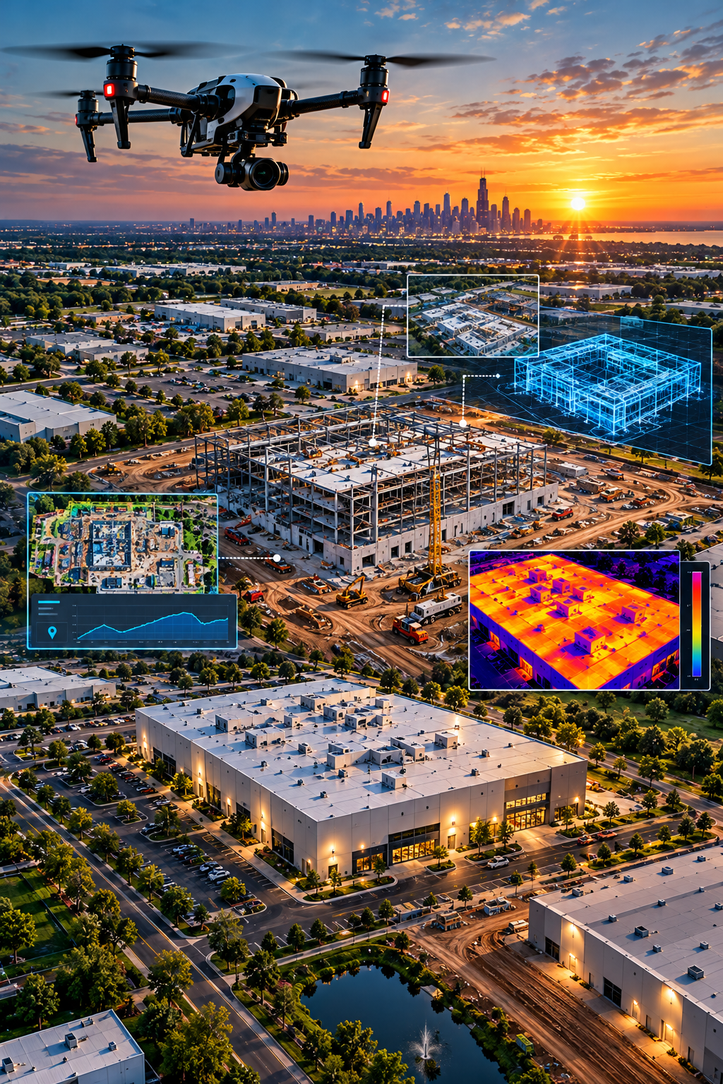
Drone-based mapping and photogrammetry use overlapping aerial images to create detailed visual representations of properties and project sites. These solutions help project teams understand site layouts, evaluate existing conditions, document changes, and support planning and development activities.
Aerial site mapping
Orthomosaic imagery
Site documentation
3D visual models
Construction planning support
Land and property assessments

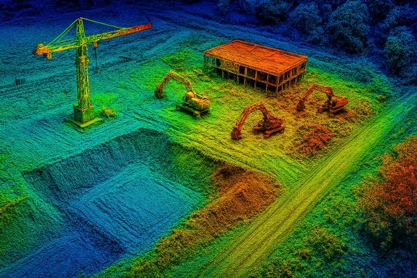
LiDAR technology uses laser measurements to collect detailed three-dimensional spatial information about terrain, structures, and surrounding environments. This technology can support land development, engineering workflows, construction planning, and detailed site analysis. Common applications include:
Terrain and topographic data collection
3D point cloud generation
Existing-condition documentation
Land development planning
Infrastructure assessments
Site modeling and analysis

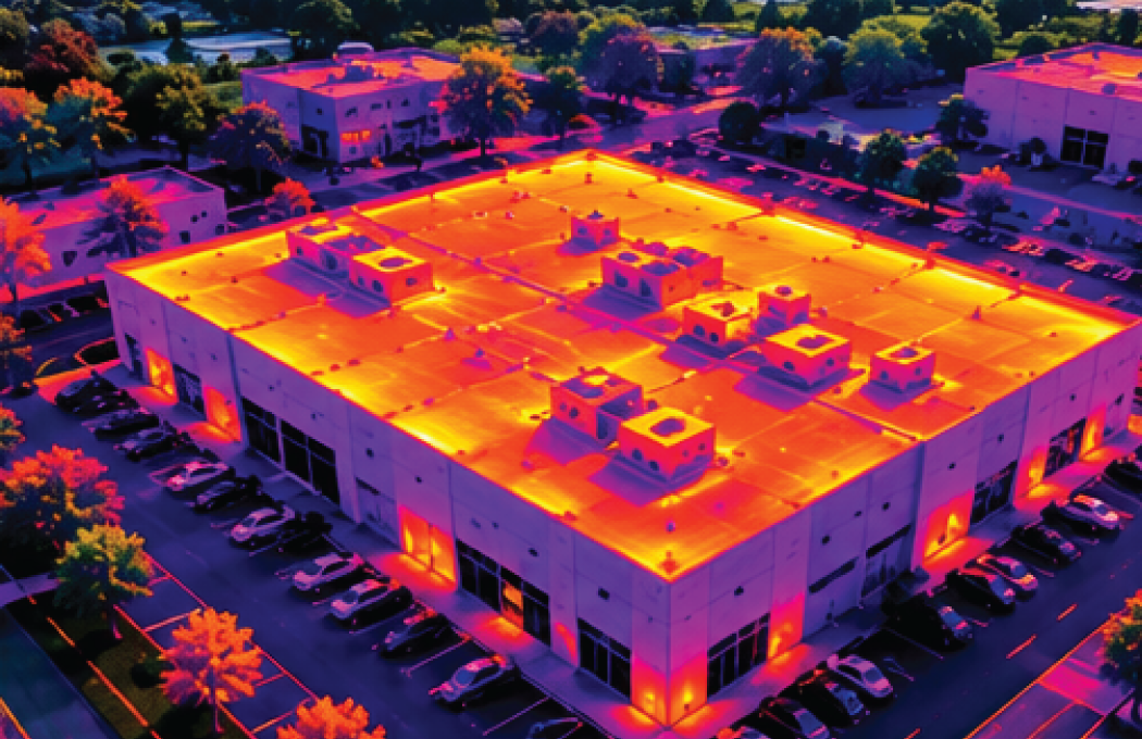
Aerial thermal imaging captures temperature differences across buildings, rooftops, equipment, and other surfaces. Thermal imagery can help identify unusual temperature patterns and areas that may require additional inspection or investigation. Common applications include:
Commercial roof assessments
Building envelope evaluations
Potential moisture-related concerns
Heat loss identification
Industrial equipment observations
Preventative maintenance documentation

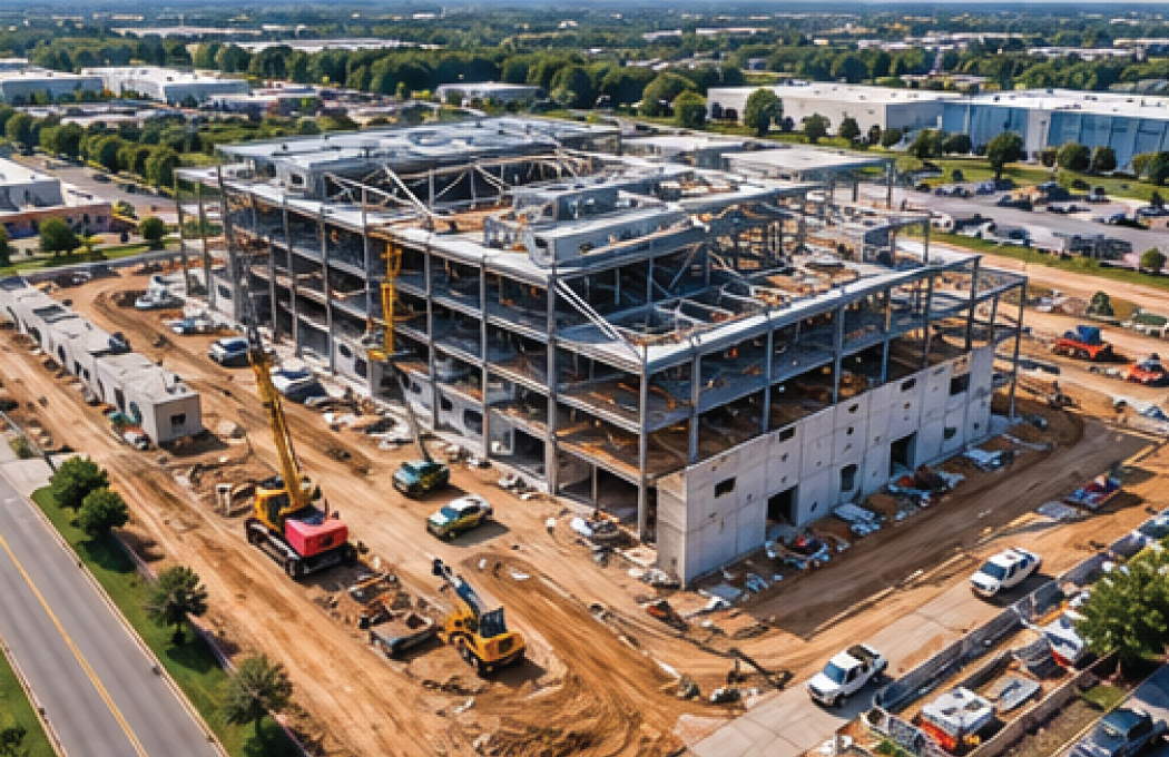
Maintain a consistent visual record of construction projects with scheduled drone photography and aerial site documentation.
Professional aerial imagery helps project managers, contractors, developers, and property owners track visible changes, review site activity, and communicate progress.
Common applications include:
Preconstruction site documentation
Scheduled construction progress photography
Site development monitoring
Project milestone documentation
Contractor and stakeholder updates
Final project imagery
Gain a comprehensive aerial perspective of large properties, construction sites, buildings, and infrastructure that may be difficult to evaluate entirely from ground level.
Collect detailed visual information across extensive or difficult-to-access areas, reducing the need for some traditional documentation methods.
Share high-resolution aerial imagery, maps, and visual records with contractors, engineers, property owners, and project stakeholders.
Document projects over time to compare site conditions, monitor visible changes, and maintain an organized record of development activity.
Drones can capture imagery of rooftops, elevated structures, and other difficult-to-access areas while reducing the need for personnel to physically access certain locations.
Use detailed aerial imagery and spatial information to support planning, property assessments, maintenance decisions, and project coordination.
We begin by discussing your project goals, property location, data requirements, and intended use of the information. This helps determine the most appropriate aerial data collection approach.
Our team evaluates the project area, operational requirements, site conditions, and appropriate imaging technology to develop an efficient collection plan.
We capture the required aerial imagery or data using drone technology selected for the project, focusing on coverage, image quality, and consistency.
Depending on the service, collected information may be organized, processed, or converted into maps, imagery, visual models, or other agreed-upon deliverables.
We provide the completed project materials in the agreed format, giving your team access to the imagery and information needed for documentation, review, and planning.
A Tort Aerials brings decades of professional photography experience together with modern drone imaging and data collection capabilities.
We understand that commercial and industrial projects require more than attractive aerial photographs. They require dependable documentation, careful planning, attention to detail, and deliverables that serve a practical purpose.
From individual property assessments to ongoing construction documentation, our goal is to provide professional aerial solutions that support your project’s objectives.
Professional drone data collection uses unmanned aircraft equipped with cameras or specialized sensors to capture aerial imagery, spatial information, and other data. This information can support mapping, inspections, construction documentation, property assessments, and project planning.
Commercial buildings, industrial facilities, construction sites, agricultural land, development properties, and large commercial real estate parcels can benefit from aerial documentation and data collection.
Traditional aerial photography primarily focuses on capturing visual images. Professional drone data collection may involve planned image capture, mapping, photogrammetry, LiDAR, or thermal imaging to produce information for analysis, documentation, or project management.
Yes. Scheduled aerial photography and site documentation can provide consistent visual records of construction activity, site changes, and project milestones throughout the development process.
Depending on the project scope and selected service, deliverables may include high-resolution aerial photographs, video, mapped imagery, 3D visual models, LiDAR point clouds, or thermal imagery. Specific formats and processing requirements should be established during project planning.
Drone imagery and mapping can support surveyors, engineers, inspectors, and project managers, but they do not automatically replace licensed surveying, engineering assessments, or required physical inspections. The appropriate methods depend on the project and its accuracy and regulatory requirements.
Whether you need detailed commercial property imagery, construction progress documentation, aerial mapping, LiDAR data collection, or thermal imaging, A Tort Aerials can help you identify the right solution for your project.
Contact us to discuss your objectives, project location, and data requirements.